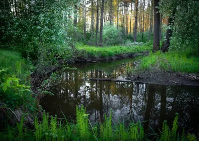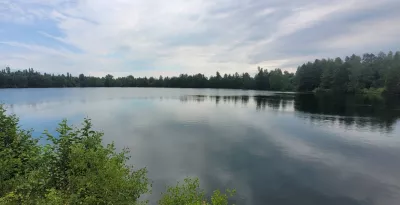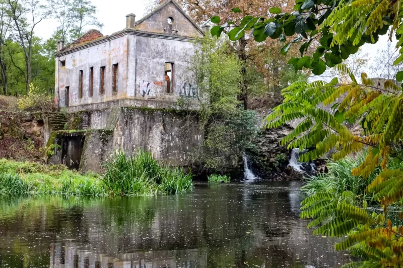

There is a river in Polissia that paddlers remember with a mix of love and a faint shiver of fear. The Uzh — a right-bank tributary of the Prypiat, 256 kilometres long and up to 40 metres wide — flows through the Zhytomyr and Kyiv regions all the way down to Chornobyl. Fed mostly by snowmelt, it once carried floated timber; today it is one of the loveliest and most accessible kayaking rivers within 150 kilometres of Kyiv.
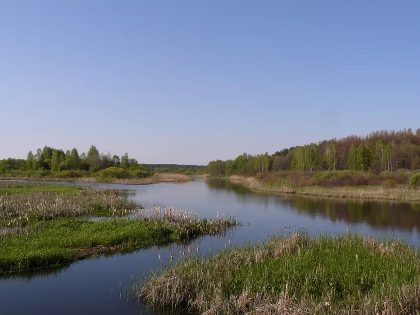
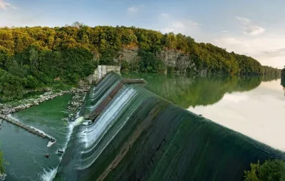
But its real signature lies elsewhere — in the abandoned, half-ruined Soviet hydro-structures scattered along it: the concrete shells of small hydroelectric plants with their man-made waterfalls, old stone weirs, and dams that either still hold back the water or stand as silent monuments to an era when planners meant to squeeze energy out of every little Polissian stream.
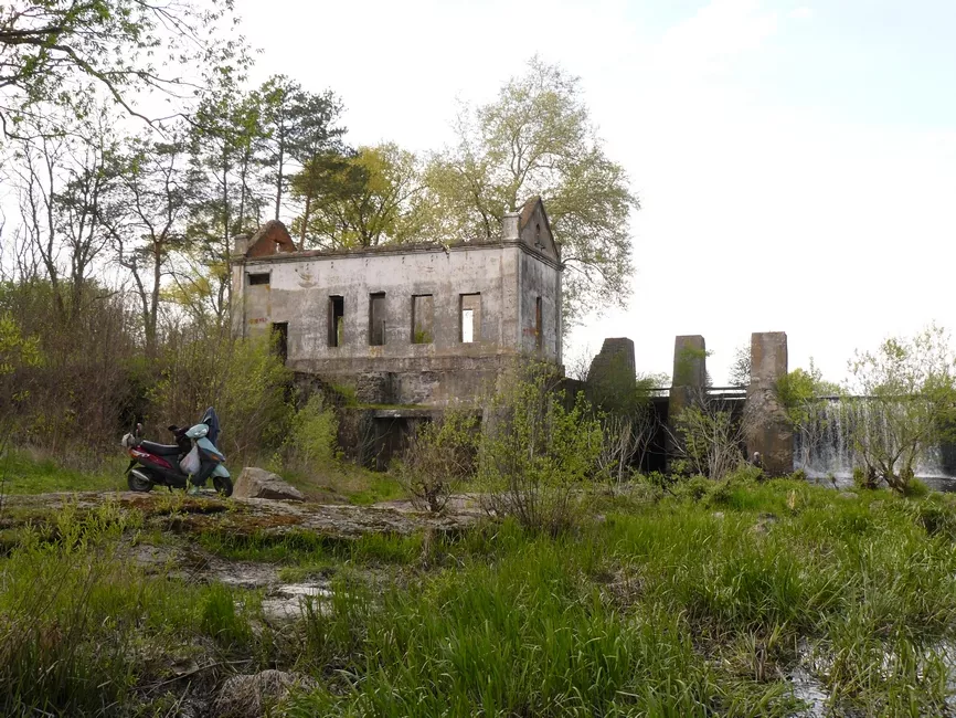
This is a place for people who prefer authenticity to glossy attractions: rusting rebar, moss-grown concrete, and the feeling that you are the first to find it.
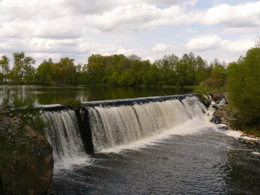
The Uzh River: what to know before you go
The Uzh around Korosten is not one river but several. In its upper reaches — from the Kamianka, Bilka and Ushytsia streams — it is a narrow, twisting ribbon that winds through the reeds and pinches down, in places, to little more than the width of a kayak. Closer to Ushomyr and Korosten the banks rise, pines and oaks appear, granite cliffs and rapids break the surface, and the river turns into a majestic Polissian beauty. Below Korosten, toward Narodychi, it changes character again, cutting a canyon through open fields.
Because of this, seasoned paddlers offer a simple rule of thumb: in April and May, run the Uzh from the village of Nedilyshche down to Korosten; for a gentle, family-friendly "light" version, put in at Ushytsia and take out at Korosten; and in June, paddle from Korosten down to Narodychi.
The river's defining feature for any traveller is the sheer number of portages — spots where you have to lift the kayak out of the water and carry it around an obstacle overland. On the 70-kilometre Korosten–Narodychi stretch alone, the Shatun touring club counted six of them. And it is precisely these obstacles — old dams, stone weirs and small hydro plants — that are the real stars of the route.
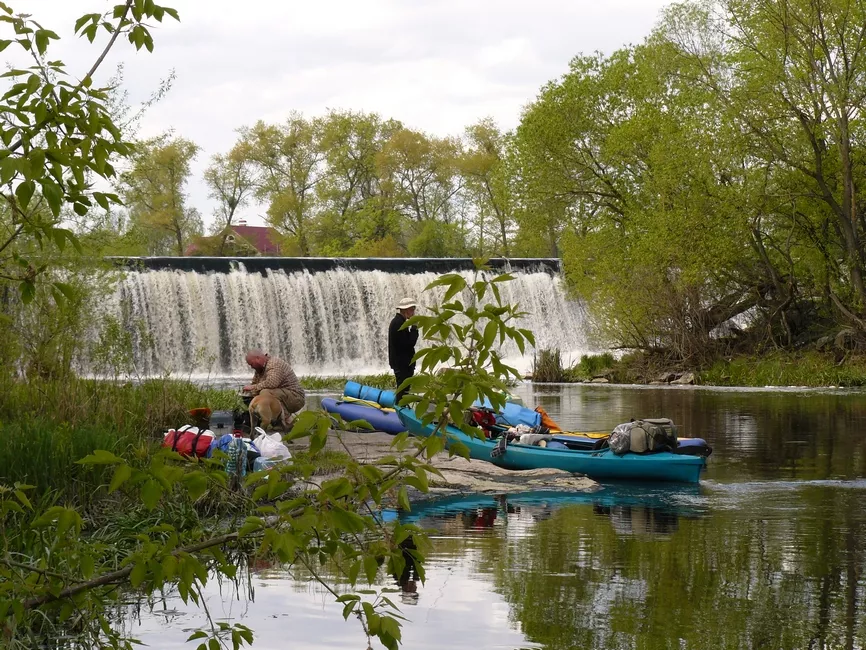
The Nemyrivka hydro plant: the famous "concrete box"
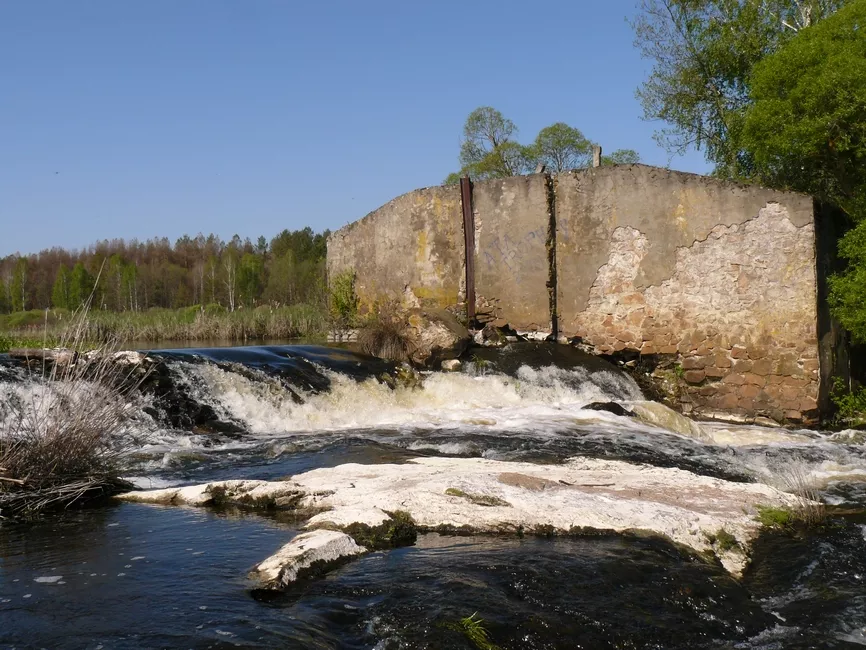
The best-known abandoned hydro-structure on the Uzh is the disused small hydroelectric plant near the village of Nemyrivka, a little upstream of Korosten. This is that solid, two-storey concrete box with its artificial waterfall — the one you have seen in most of the region's "atmospheric" social-media photos. The dam blocks the river completely, forming a small pool, and just past the concrete structure the river narrows sharply before a low concrete footbridge.
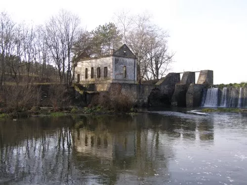
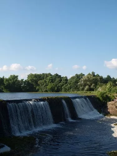
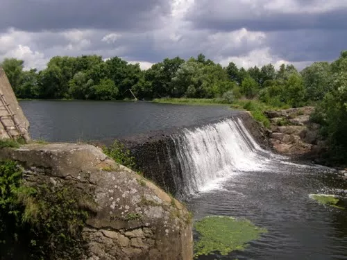
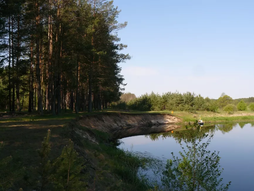
For paddlers this is a classic portage point, along the right bank. In the Shatun club's report, this is the first portage described on the run down from Korosten; below it the river spreads out once more into a miniature reservoir, and further on there is a comfortable overnight spot in a pine wood on the right bank, "just before you reach the village of Bardy."
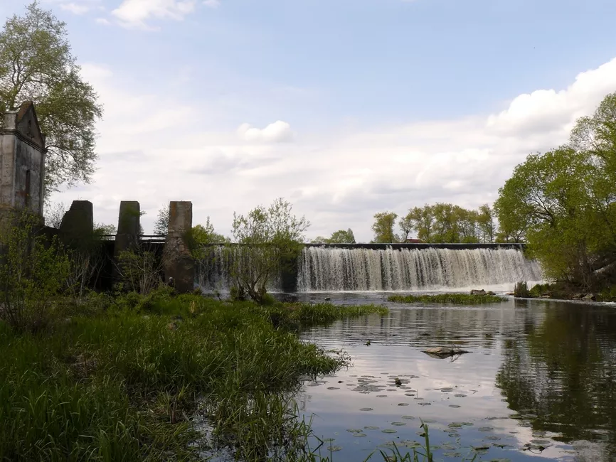
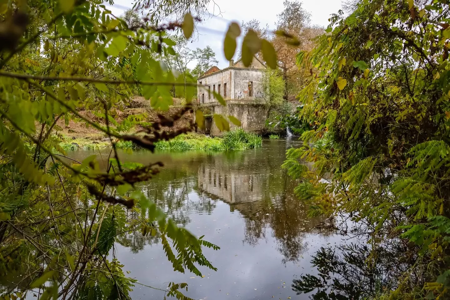
The plain field notes read: At Nemyrivka the dam no longer works — first portage, right bank.
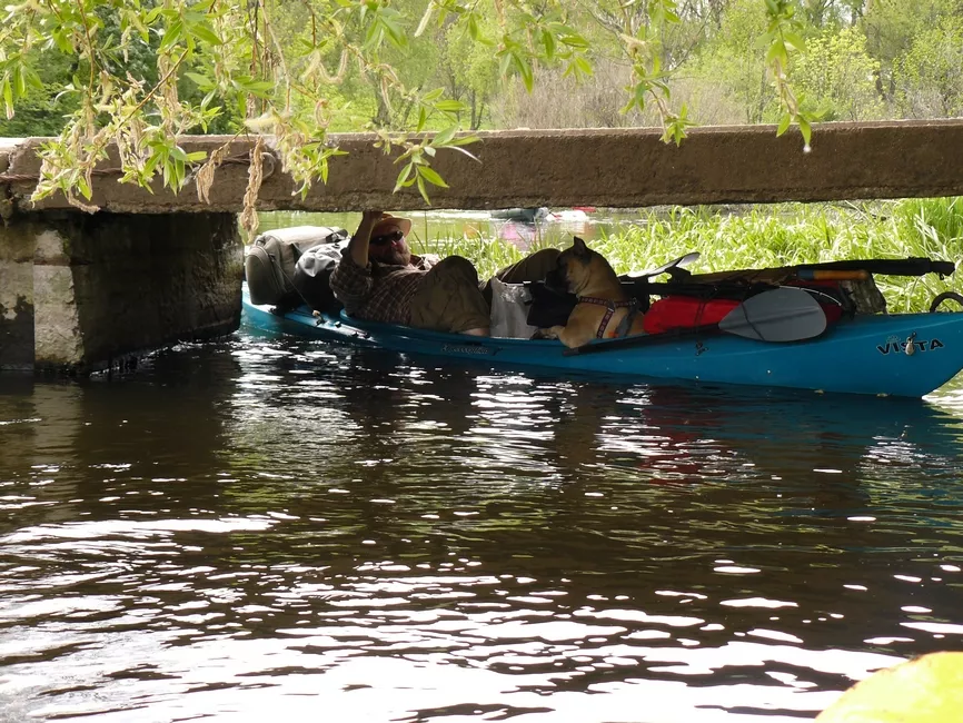
Immediately below the dam, a low concrete footbridge; we squeezed through the left span.
Nemyrivka itself is a place steeped in history. It is believed that here, in the year 945, the Drevlians killed the Kyivan prince Ihor, and the village still keeps a burial mound topped with a cross and a memorial marker that is held to be his grave. (According to the chronicle, his body was later reburied in the village of Mohylne, today's Poliske.) So a trip to the Nemyrivka plant is at once industrial tourism and a brush with one of the most dramatic legends of Kyivan Rus.
Nemyrivka or Bardy? Clearing up the confusion
This is the single most common mistake in blogs and angling reports, so it is worth settling once and for all.
Paddlers often label the Nemyrivka plant as "the hydro plant near Bardy," because it sits just a few kilometres upstream of Bardy, closer to the former hamlet of Vorone. In many blogs the two neighbouring villages are simply merged into one location.
The simple rule: if you see a large, abandoned concrete "box" with a waterfall on the Uzh just above Korosten, that is Nemyrivka — even if local anglers and bloggers call it "Bardy" out of habit.
Bardy: a fishing spot downstream
The village of Bardy, downstream of Nemyrivka, is better known as a fishing spot. Angling on the Uzh near Bardy is free, and the species anglers mention include crucian carp, carp, roach, bream, rudd, pike and perch. It is exactly this pairing — good fishing at Bardy alongside the half-ruined hydro-structures — that makes the area a draw for anglers and urban-exploration fans alike.
Ushomyr: an old stone weir and a regulating dam
Another rewarding stop is the large village of Ushomyr, where the river carries two structures at once. The first is a more modern regulating dam.
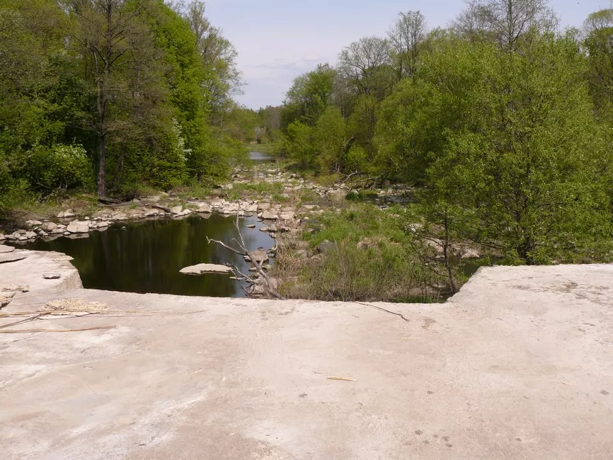
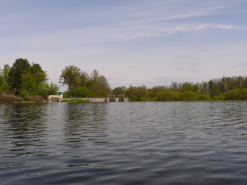
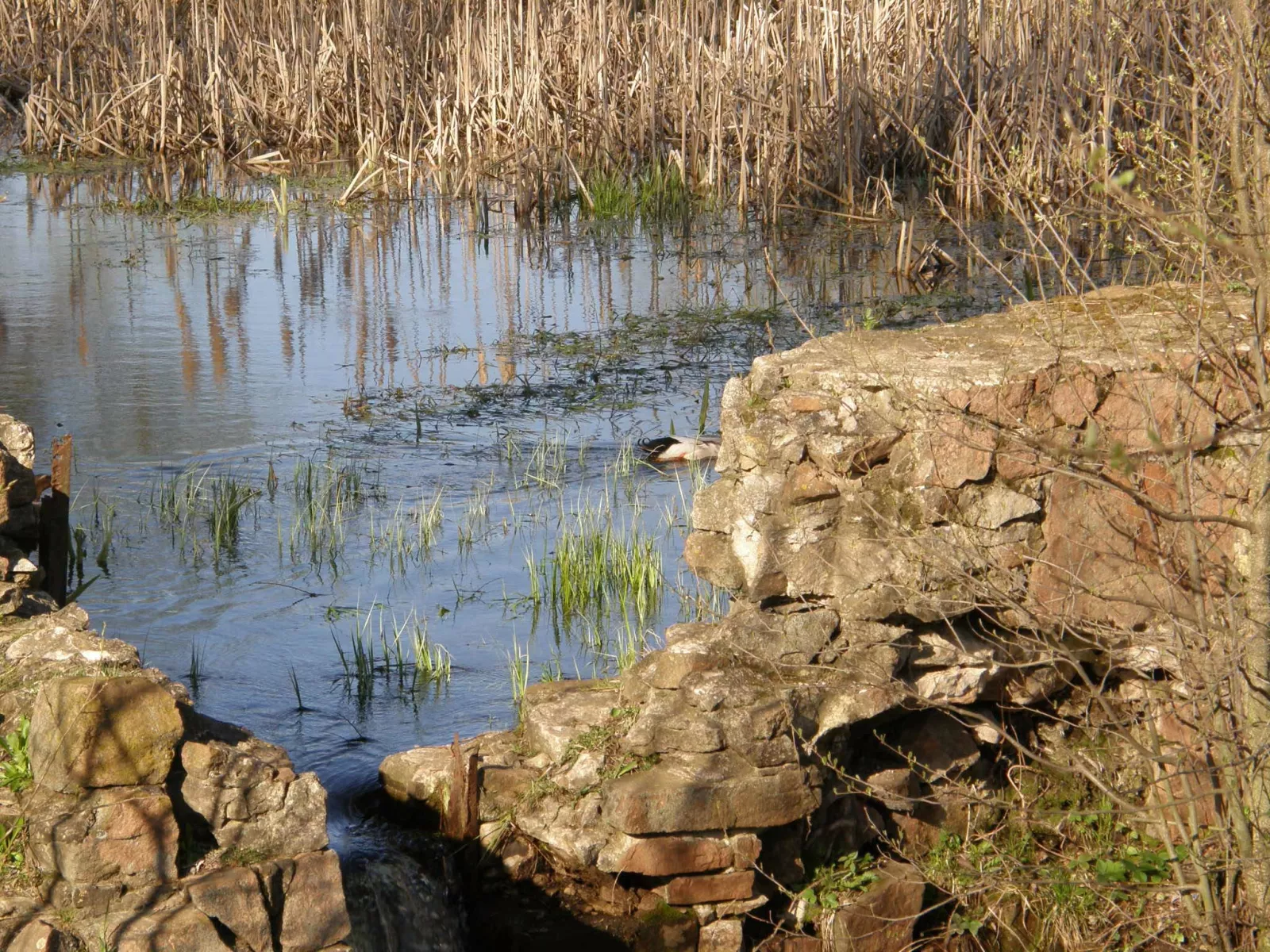
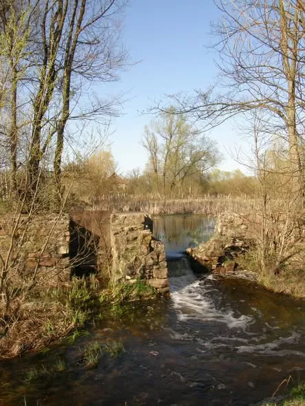
The second — and this is the real prize for lovers of the authentic — comes right at the edge of the village, just past the iron footbridge, where an old historic stone weir crosses the river. Beside it sit a small holiday base and a changing hut. This stone weir is a popular, genuinely old landmark that remains a recognisable waypoint on the route even now that a more modern structure has gone up nearby.
The Rozsokhivske plant: in ruins
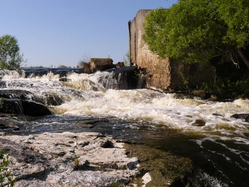
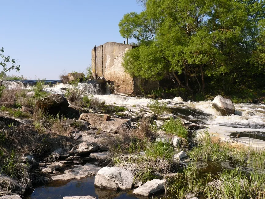
The route's furthest hydro-structure stands near the village of Rozsokhivske (in the Narodychi community; until 1946 the village was called Khutir-Rozsokhivskyi). Here you will find a ruined mini-hydro plant — the last, sixth obstacle on the 70-kilometre run to Narodychi. Only fragments of the concrete dam remain, and this stretch of river is so thickly overgrown with reeds that, from the water, it can be hard to tell where to steer or where exactly to portage. Paddlers advise pulling in to the left bank and scouting the obstacle on foot rather than charging in blind. The portage itself is straightforward, along the right bank. There is no separate documented history of this particular plant — no build date, no capacity — in open sources; it is a typical Soviet rural mini-hydroelectric station, one of dozens once built on Polissia's rivers, long since out of service.
What else to see on the Uzh
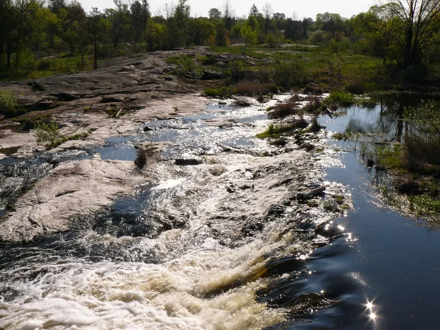
The dams and abandoned plants are really a bonus for the urban explorer. The Uzh's main appeal lies elsewhere: this is one of Polissia's most beautiful granite rivers, with a geology, a history and a mythology all its own. Here is what to watch for on the route, beyond the hydro-structures.
Granite cliffs with names of their own
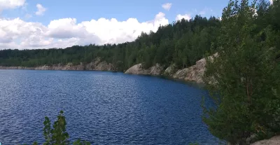
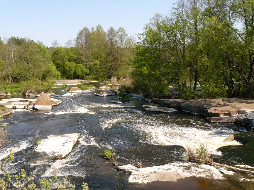
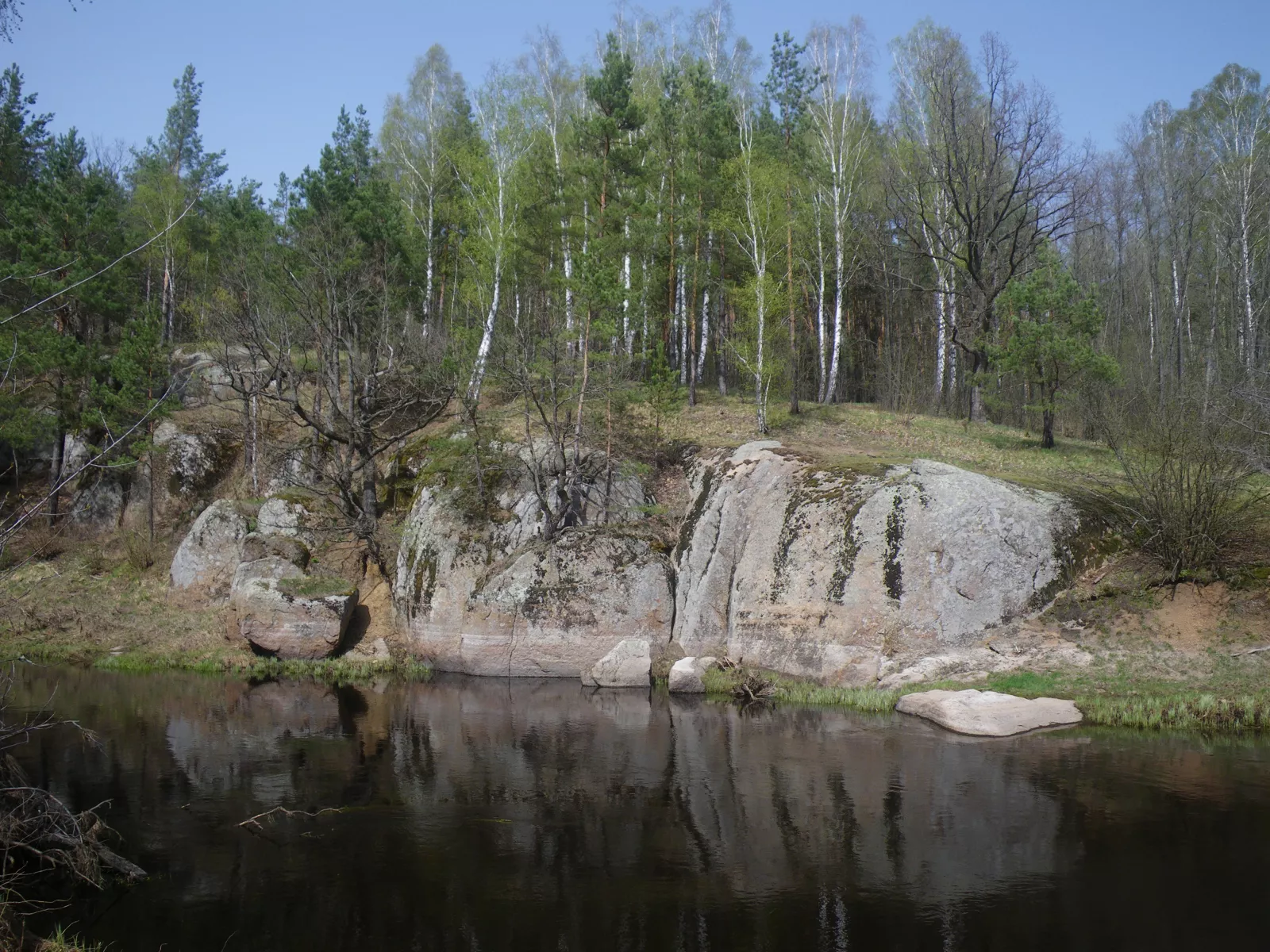
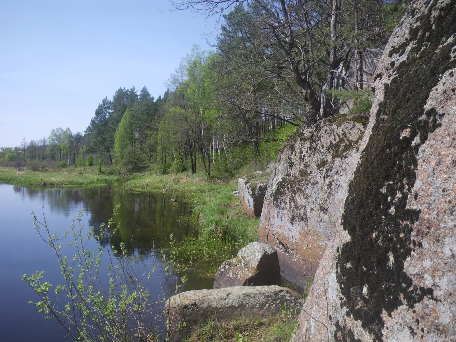
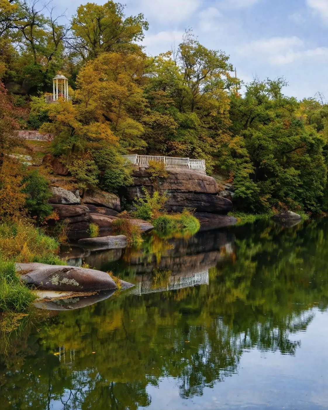
What leaves the strongest impression on the Uzh is not the dams but the cliffs. The river cuts through an ancient granite canyon and, near Korosten, runs beneath a thirty-metre precipice — clear, cold and fast, almost like a mountain stream, among enormous red granite boulders. The most famous outcrops carry their own legendary names: "Perun's Shoulders," "the Rams' Foreheads," "Olha's Baths" and "the Giant's Cauldrons." These are protected geological monuments of local significance. Their crowns are smoothed flat — the mark of an ancient glacier — and within the stone you can find flint deposits bearing the imprints of sea shells: in the Cretaceous, this land lay under a sea.
The Korosten Pluton: world-class geology
The cliffs of the Uzh are the visible tip of the Korosten Pluton, a colossal massif of rock whose foundations reach back to the Precambrian — up to 3.5 billion years old. Geologists the world over know the pluton: it is the source of the famous Ukrainian labradorite — that "moonstone" that flashes blue, black and green, ranked in geology alongside the massifs of Labrador in Canada. Standing on the banks of the Uzh, in other words, you are quite literally touching one of the oldest rocks on the planet.
"Skelia": a bunker inside the granite cliff
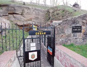
Right above the Uzh, in Korosten's Drevlyansky Park, hidden within a great mass of granite, lies the military-history complex "Skelia" ("the Rock") — a reserve command post for the Southwestern Front headquarters, built in 1935–1937 as part of the Korosten fortified district. Today it is a museum open to guided tours; tour operators often bill it as "Stalin's bunker." One of the most enigmatic military-history sites in all of Polissia — and it sits on this very river.
Pillboxes of the Korosten fortified district
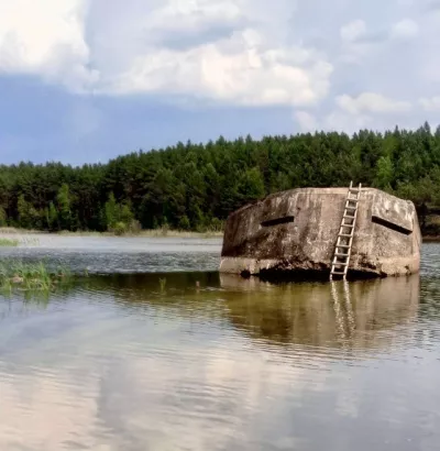
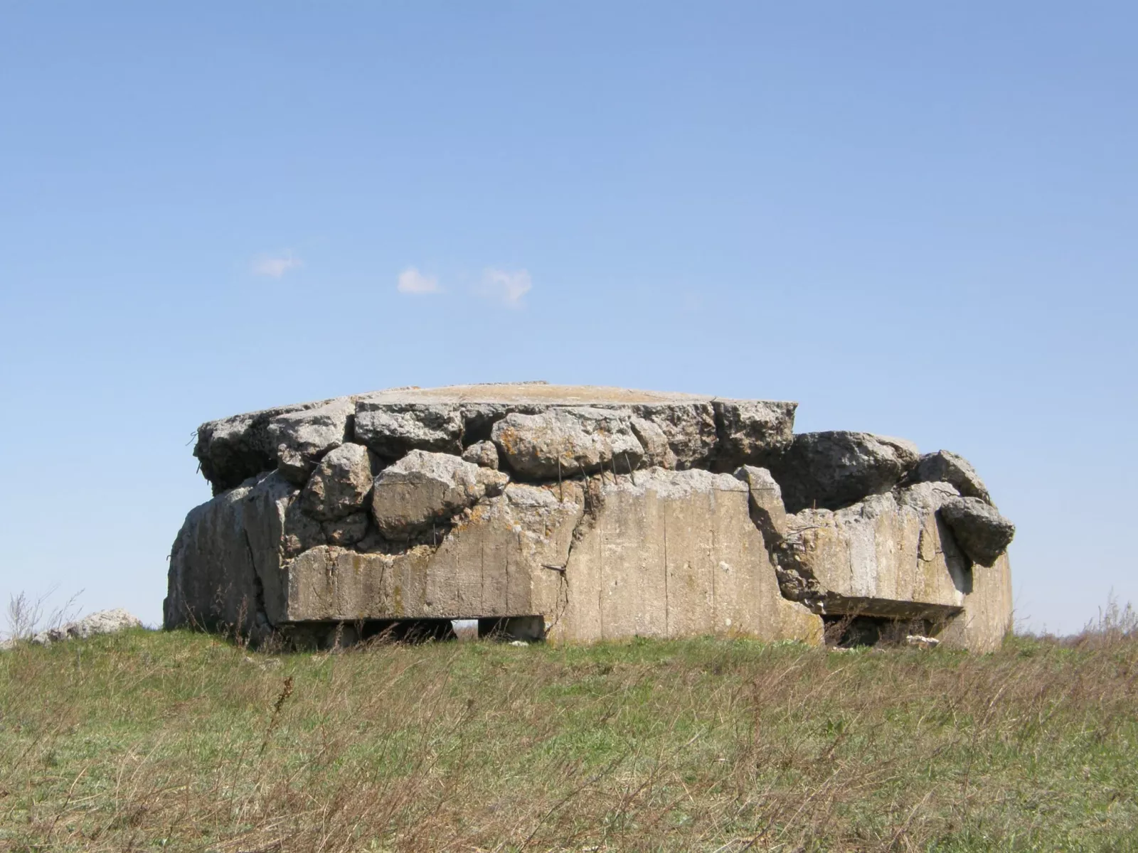
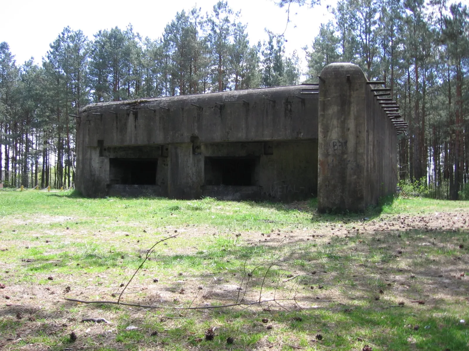
Beyond "Skelia," the fortified-district line left field fortifications along the river too. On a pine-clad hill on the right bank near the village of Ushytsia stands a blown-up pillbox. The stone weir across the river nearby is most likely the remains of an old crossing that the pillbox was meant to cover with fire. Local paddlers call this "a place of power" — for its natural beauty and its old firepower alike.
The "Cliff of Love"
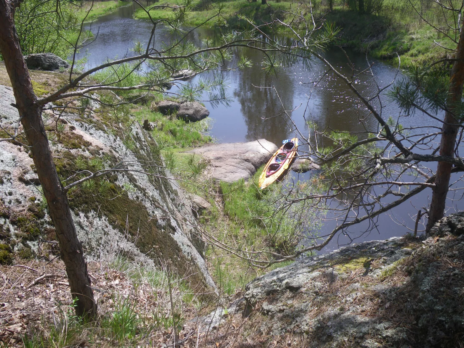
Beyond the village of Strumok, on the left bank, is a picturesque rocky spot around which tour operators build entire kayaking trips. Paddlers stop here for the "Cliff of Love," wrapped in local legend, where the view from the top recalls the landscapes of the Far North. A perfect photo stop on the route.
The wooden Church of St Nicholas, 1772
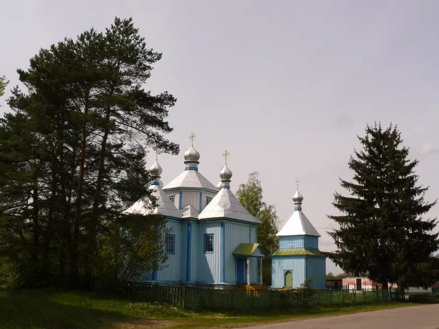
In the village of Mezhyrichka, right on the route, the wooden Church of St Nicholas from 1772 still stands — a rare surviving example of Polissian sacred architecture.
The town dam in Korosten and Drevlyansky Park
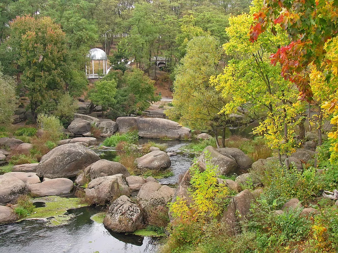
Within Korosten itself, the Uzh is regulated by a hydro-structure near the site of the former meat-packing plant. It keeps the water level up along the famous Drevlyansky Park (also known as Ostrovsky Park), the true jewel of the town. The park spreads across the granite banks of the Uzh, where thousands of years ago a glacier strewed vast stone boulders, creating a singular landscape of rapids and cliffs.
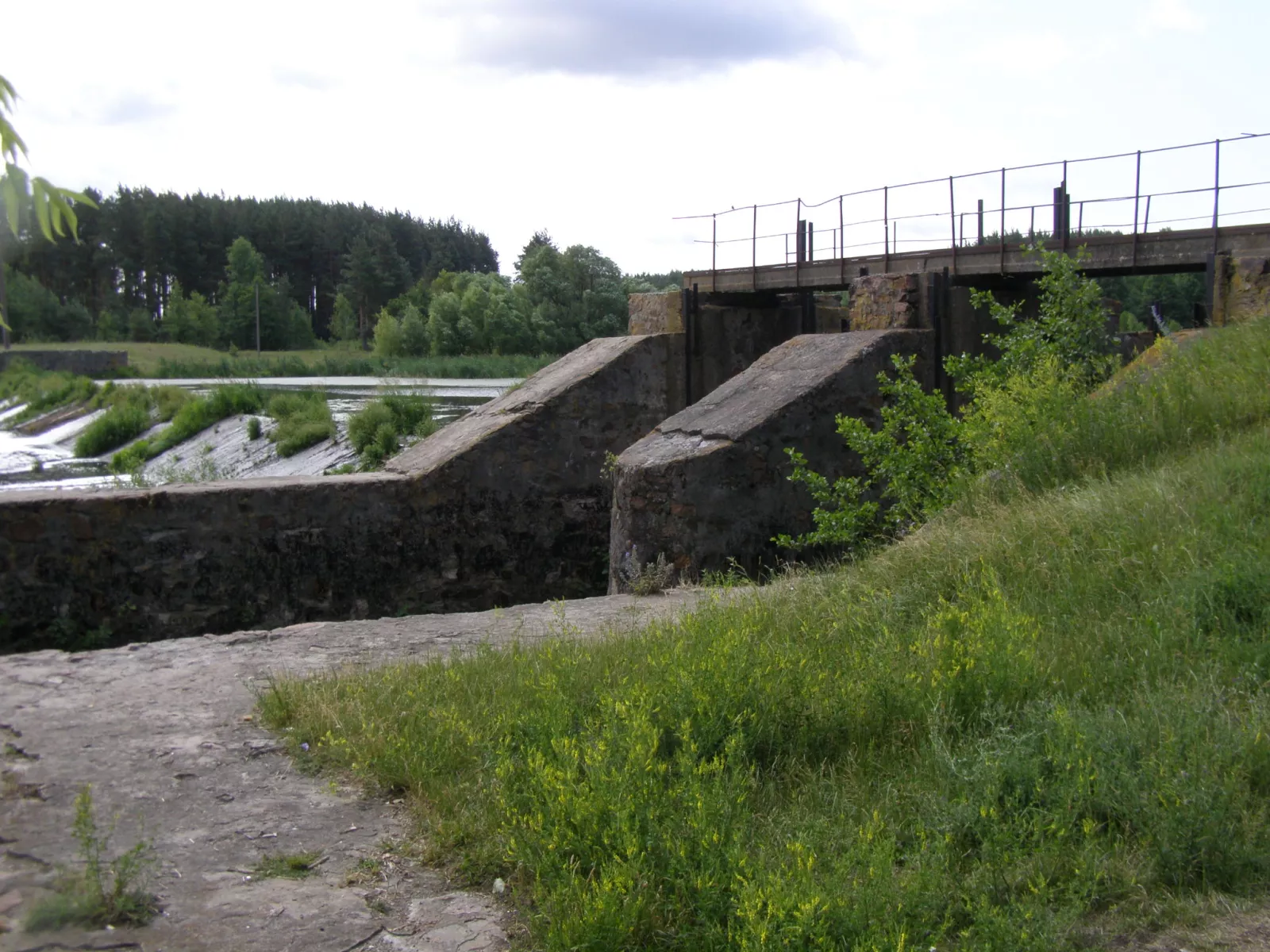
The structure is still in service, but because of its age and design the river here periodically fills with the rare water chestnut and begins to look like a neglected swamp, so it has to be cleared out regularly with heavy machinery.
Drevlyansky Park itself has plenty to see: a monument to Prince Mal atop a granite cliff (put up here back in 2005 — not to be confused with the wooden Mal monument in Malyn from 2018; these are different objects in different towns), a reconstruction of the wooden fortifications of ancient Iskorosten, a monument to Princess Olha beside "Olha's Baths," and the "Skelia" military-history complex — the command post inside the cliff, built in 1935–1937 as part of that same Korosten fortified district.
Practical information for your trip
Getting there. The route begins near Korosten, about 150 km from Kyiv along the Warsaw highway. Paddlers leave their cars in the lot by the Korosten Hotel and arrange a shuttle van to the put-in.
When to go. April and May (high water) are best for running the upper reaches; June suits the stretch below Korosten. Bear in mind that on sections below working hydro plants the water level can drop on weekends and holidays, when the station is switched off.
Who it's for. With its many portages, the route better suits experienced paddlers or families with some background; there is a "light" version for children from Ushytsia down to Korosten.
What to bring. Footwear you won't mind soaking (expect plenty of lining-down and portaging), protection from sun and wind, a supply of drinking water (the river water itself is yellowish in places), and — without fail — bags to pack out your own rubbish.
A word of caution. The abandoned concrete structures are tempting, but they are half-ruined — don't climb unstable constructions over the water. Before running any dam or weir, paddlers are advised to pull in and scout the obstacle from the bank rather than charge in blind.
Water safety. There are no lifeguards out here, and the riffles and rapids add their own adrenaline — a life jacket is essential, especially for children.
The greatest asset of this route is its honesty. There are no tickets, no ticket booths, no souvenir kiosks. There is only the river, the Soviet-era concrete slowly surrendering to nature, stone weirs older than any power plant, and Polissian landscapes that take your breath away. If you are looking for a place to feel like an explorer just 150 kilometres from the capital, the Uzh is waiting.
Frequently asked questions
Where is the most famous abandoned hydro plant on the Uzh? Near the village of Nemyrivka, a little upstream of Korosten — a solid concrete structure with an artificial waterfall.
Why is this plant called "Nemyrivka" by some and "Bardy" by others? Because Bardy is a neighbouring village a few kilometres downstream, and many blogs conflate the two; the abandoned plant itself stands in Nemyrivka.
Is the Nemyrivka plant still working? No — it is a disused, half-ruined small hydroelectric plant.
Are there any working hydro plants on the Uzh? Yes. Downstream of Nemyrivka, paddlers mention a working plant that was switched on during the week to raise the water level and shut off at weekends.
What is a "portage" on a kayaking route? It is a spot where you have to lift the boat out of the water and carry it around an obstacle — a dam, a weir, a footbridge — overland.
How many portages are there on the Korosten–Narodychi route? According to the Shatun touring club's report, six portages over 70 km.
Can you fish near Bardy? Yes — angling on the Uzh near Bardy is free; you can catch crucian carp, carp, roach, bream, rudd, pike and perch.
What's interesting in Ushomyr? An old historic stone weir at the edge of the village and a more modern regulating dam, with a holiday base nearby.
What are the pillboxes of the Korosten fortified district on the route? Remains of Soviet fortifications from the 1930s; a blown-up pillbox stands on a hill near the village of Ushytsia, above an old river crossing.
Where do you start the Uzh kayaking route? Depending on the season — from the village of Nedilyshche or Ushytsia (spring) or from Korosten (summer); cars are usually left by the Korosten Hotel.
How far is it from Kyiv? Korosten lies roughly 150 km from Kyiv.
What is Drevlyansky Park in Korosten? The town's central park on the granite banks of the Uzh, with monuments to Prince Mal and Princess Olha and the "Skelia" military-history complex.
Is it safe to climb on the abandoned plants? No — the structures are half-ruined; don't climb onto unstable concrete over the water.
When is the best time to go paddling? April–May for the upper river, June for the stretch below Korosten.
Is the route suitable for children? There is an easier "light" version from Ushytsia to Korosten, but because of the portages and rapids children need constant supervision and life jackets.
What else, besides the dams, is the Uzh known for? Granite cliffs with names of their own ("Perun's Shoulders," "the Rams' Foreheads," "Olha's Baths"), the geology of the Korosten Pluton (up to 3.5 billion years old), the "Skelia" bunker and the "Cliff of Love."
What is the Korosten Pluton? A colossal massif of ancient rock and the source of the famous Ukrainian labradorite; its cliffs surface right on the banks of the Uzh.
What is the "Skelia" complex in Korosten? A reserve command post from 1935–1937 built inside a granite cliff above the Uzh, part of the Korosten fortified district; today a museum that tour operators call "Stalin's bunker."